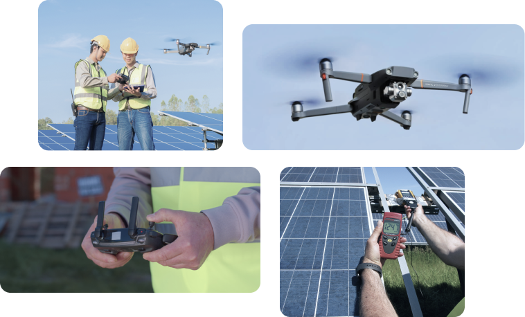
Utilise your in-house drone pilots or take advantage of Sitemark’s worldwide network of certified independent drone operators.
Fly with Sitemark
Data Quality
Our pilots acquire data of the highest quality. Each inspection has a strict quality check process performed by our dedicated team.
Project Management from A-Z
A dedicated coordinator will plan and execute your inspections, without adding any additional workload to your team, allowing them to focus on other tasks.
Global Pilot Network
Access a network of highly skilled Sitemark certified pilots and scale your operations worldwide.
Fly it Yourself
Flexibility
Plan according to your own priorities and availabilities.
Onboarding of your in-house team
Take advantage of our team’s knowledge and expertise in flight planning and coordination. Train your team to carry out the flights autonomously with your own equipment.
Operational Support
We offer seamless operational support to make sure that your team carries out the flights effectively and captures good quality data.
Recommended Hardware
Sitemark’s Fuse Platform is compatible with many drones and cameras for acquiring and processing.
Check out the complete list of drones and sensor requirements.
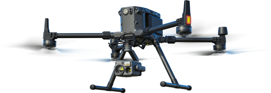
General Information
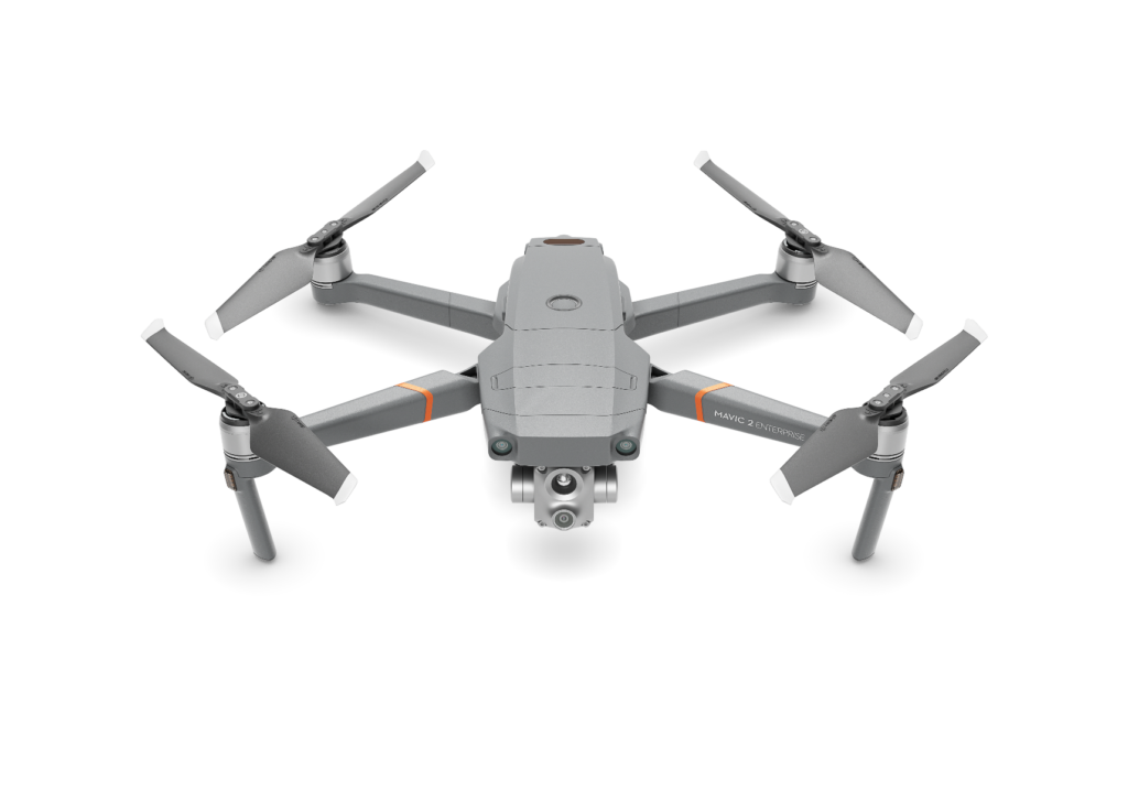
DJI’s dominating commercial drone platform, released in 2020. Powerful Master Drone system accompanied by the newest thermal H20T sensor. The must-have for Enterprise payload requirements.
Highlights 💡
- Up to 55 minutes of flight time
- Wind resistance (up to 15 km/h)
- 6 directional sensing & positioning
- AI Spot-Check
- RTK system
- Gimbal support for multiple sensors (DJI H20T, DHI 420 series, DJI P1, Zenmuse XT2
General Info
DJI’s most awaited, compatible & powerful portable drone, released in 2021. A perfect ready-to-fly combo for solar inspections and mapping flights. The price and quality of the end results make it a perfect choice for all-size companies.
Highlights 💡
- 2-in-1 (handy/ portable)
- Dual Imaging
- Built in 48MP Visual Camera
- Built in Radiometric thermal camera
- Built in 32× Digital Zoom
- RTK system (optional)
General Info
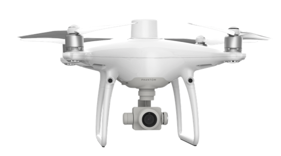
DJI’s first survey-focused UAV and most popular drone continuing the legacy of the Phantom 4 series in terms of price, quality and reliability. This drone comes with a built-in gimbal camera.
The RTK module is integrated directly into the Phantom 4 RTK, which is tagging images with positional data in real time.
Highlights 💡
- 20 MP Visual Camera
- All-in-one
- On-board real-time kinetic sensor
- High level of accuracy (centimeter-level positioning data)
- Remote Controller with built-in screen
- Compatibility with D-RTK 2 Mobile Station
General Info
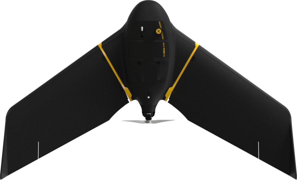
The eBee X is a traditional fixed-wing mapping & surveying drone that, unlike other drones, requires hand launching and lands on its belly.
Mapping drone for large-scale surveys with unmatched data quality at a fraction of the time and cost.
The SenseFly S.O.D.A. is the first photogrammetry camera built for professional drone use and has quickly become the reference sensor in its field.
Highlights 💡
- 1-inch 20 MP RGB sensor
- Enables simple RTK/PPK workflows with senseFly’s optional GeoBase plug-and-play GNSS receiver
- Maximum flight time of 90 min
General Info
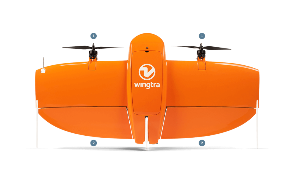
With its vertical take-off and landing (VTOL) capability, the Wingtra One mapping & surveying drone combines the cruising flight efficiency of fixed-wing aircraft with the convenient vertical landing of multirotor. The combination with Sony RX1R II 42MP makes a perfect duo for large projects.
Mapping drone for large-scale surveys with unmatched data quality at a fraction of the time and cost.
Highlights 💡
- 42 MP camera (Sony RX1R II 42MP)
- Efficient fixed-wing flight
- Correction complete immediately after flight
- Offers real-time, highly-accurate position of the drone (RTK)
- Onboard GNSS RTK receiver
- Faster than multicopter drones
- Terrain following
- Corridor mapping
- Maximum flight time of 59 min
- Vertical take-off and landing (VTOL)
Are you a pilot and interested in joining our pilot network?
Get in touch and let us know.