About GoldenEye EU H2020
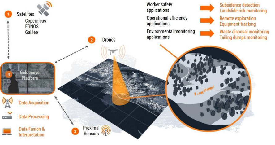
The Goldeneye project will implement a unique combination of remote sensing and positioning technologies, exploiting Earth observation and Earth GNSS data, together with data fusion and processing powered by data analytics and machine-learning algorithms.
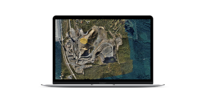
The platform will allow satellites, drones, and in-situ sensors to collect high-resolution data of the entire mine, which can be processed and converted into actionable intelligence for safety, environmental monitoring, and overall productivity, allowing more efficient exploration, extraction, and closure.
These tools will be demonstrated in 5 field trials in Germany, Bulgaria, Romania, Kosovo, and Finland, creating a compelling value proposition for implementation across the mining industry value chain.
The project will run for three years and an EC funding of €8.36M. The consortium includes a significant industrial partner, 7 SMEs, four academic/research centers, and four end-users, supported by a strong advisory board of experts in geosciences.